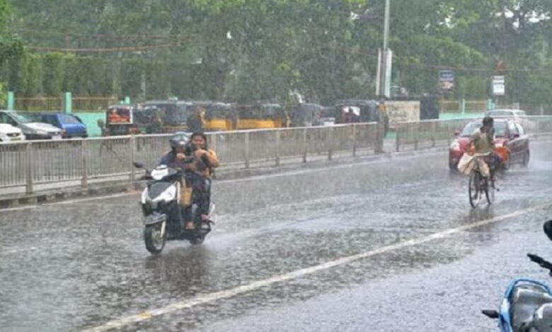
Fresh lowpressure area over BoB! Odisha to witness rain for 5 days
Bhubaneswar: A cyclonic circulation (remnant of Tropical Cyclone WIPHA) is likely to emerge over north Bay of Bengal during next 24 hours, predicted the India Meteorological Department (IMD) adding that under its influence, a Low Pressure area is likely to form over the same region during subsequent 24 hours.
The weather department has said that several parts of Odisha will witness rainfall in the next five days. For this, it has issued yellow, orange and red warnings for the weather activity.
Day 1 (Valid upto 8.30 AM of July 24):
- YELLOW WARNING: Heavy Rain and Thunderstorm with lightning with gusty surface wind speed reaching 30-40 kmph very likely to occur at one or two places over the districts of Koraput, Malkangiri, Nabarangpur, Gajapati, Mayurbhanj, Rayagada and Keonjhar.
- Thunderstorm with lightning with gusty surface wind speed reaching 30-40 kmph very likely to occur at one or two places over the districts of Balasore, Bhadrak, Jajpur, Kendrapara, Cuttack, Jagatsinghpur, Dhenkanal, Sundargarh, Jharsuguda, Bargarh, Sambalpur, Deogarh, Angul, Puri, Khurda, Nayagarh, Ganjam, Bargarh, Sonepur, Boudh, Nuapada, Kalahandi and Kandhamal.
Day 2 (Valid from 8.30 AM of July 24 to 8.30 AM of July 25):
- ORANGE WARNING: Heavy to Very Heavy Rain and Thunderstorm with lightning with gusty surface wind speed reaching 30-40 kmph very likely to occur at one or two places over the districts of Mayurbhanj, Keonjhar, Malkangiri and Koraput.
- YELLOW WARNING: Heavy Rain and Thunderstorm with lightning with gusty surface wind speed reaching 30-40 kmph very likely to occur at one or two places over the districts of Sundargarh, Deogarh, Balasore, Bhadrak, Kendrapara, Jajpur, Dhenkanal, Angul. Thunderstorm with lightning with gusty surface wind speed reaching 30-40 kmph very likely to occur at one or two places over the districts of Cuttack, Jagatsinghpur, Puri, Khurda, Nayagarh, Ganjam and Gajapati.
Day 3 (Valid from 8.30 AM of July 25 to 8.30 AM of July 26):
- RED WARNING: Extremely Heavy Rain and Thunderstorm with lightning with gusty surface wind speed reaching 30-40 kmph very likely to occur at one or two places over the districts of Mayurbhanj and Keonjhar.
- ORANGE WARNING: Heavy to Very Heavy Rain and Thunderstorm with lightning with gusty surface wind speed reaching 30-40 kmph very likely to occur at one or two places over the districts of Balasore, Bhadrak, Jajpur, Angul, Dhenkanal, Kendrapara, Jagatsinghpur and Sundargarh.
- YELLOW WARNING: Heavy rain and thunderstorm with lightning with gusty surface wind speed reaching 30-40 kmph very likely to occur at one or two places over the districts of Bargarh, Cuttack, Nayagarh, Khurda, Boudh, Sonepur, Nabarangpur, Koraput, Kandhamal, Sambalpur, Jharsuguda, Deogarh, Bolangir, Nuapada, Kalahandi. Thunderstorm with lightning with gusty surface wind speed reaching 30-40 kmph very likely to occur at one or two places over the districts of Puri, Ganjam, Gajapati, Rayagada and Malkangiri.
Day 4 (Valid from 8.30 AM of July 26 to 8.30 AM of July 27):
- ORANGE WARNING: Heavy to Very Heavy Rain and Thunderstorm with lightning with gusty surface wind speed reaching 30-40 kmph very likely to occur at one or two places over the districts of Mayurbhanj, Keonjhar, Sundargarh.
- YELLOW WARNING: Heavy rain and thunderstorm with lightning with gusty surface wind speed reaching 30-40 kmph very likely to occur at one or two places over the districts of Dhenkanal, Angul, Deogarh, Sambalpur, Jharsuguda, Bargarh, Malkangiri, Koraput and Gajapati.
- Thunderstorm with lightning with gusty surface wind speed reaching 30-40 kmph very likely to occur at one or two places over the districts of Balasore, Bhadrak, Jajpur, Kendrapara, Cuttack, Jagatsinghpur, Puri, Khurda, Nayagarh, Ganjam, Sonepur, Boudh, Nuapada, Balangir, Kalahandi, Kandhamal, Nabarangpur and Rayagada.
Day 5 (Valid from 8.30 AM of July 27 to 8.30 AM of July 28):
- YELLOW WARNING: Heavy rain and thunderstorm with lightning with gusty surface wind speed reaching 30-40 kmph very likely to occur at one or two places over the districts of Bargarh, Jharsuguda, Sambalpur and Sundargarh.
- Thunderstorm with lightning with gusty surface wind speed reaching 30-40 kmph very likely to occur at one or two places over the districts of Deogarh and Angul, Dhenkanal, Keonjhar, Mayurbhanj, Sonepur, Boudh, Nuapada, Bolangir, Kalahandi, Kandhamal, Nabarangpur, Rayagada, Koraput and Malkangiri.
Meanwhile, fishermen are advised not to venture into north and along & off Odisha, West Bengal and Bangladesh coasts during July 24 to July 27, 2025.